All posts in Multi-Purpose Trail

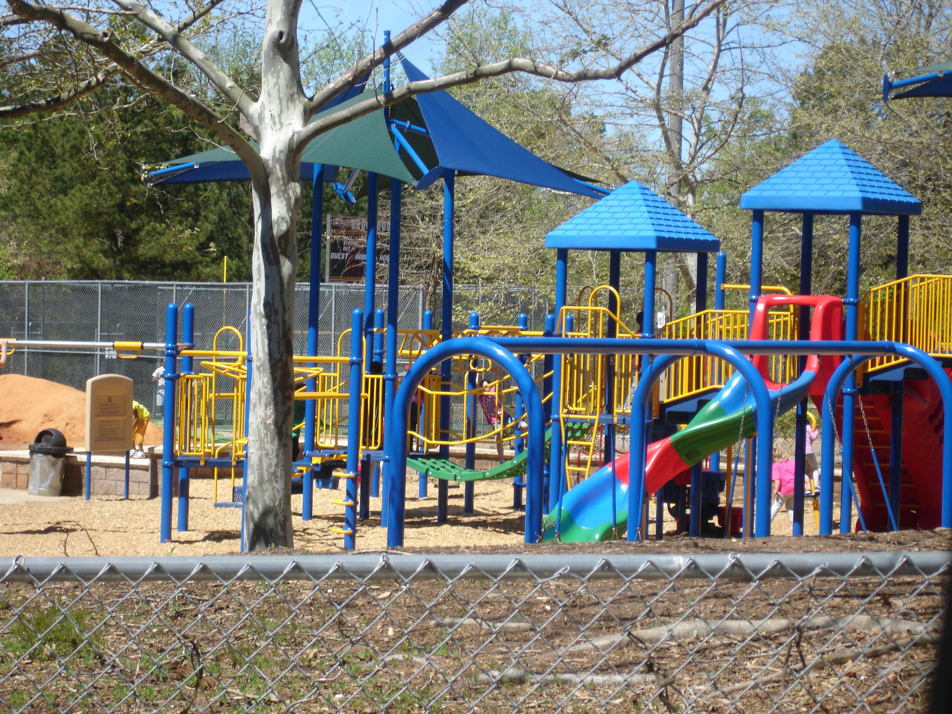
Park Profile: Bethesda Park Information, Hours [PHOTOS]

BethesdaPark_playground

225 Bethesda Church Road, Lawrenceville 30044
Park Hours: Sunrise until 11:00pm unless posted otherwise
Aquatic Center Hours: Click Here
Amenities ∙ 159 acres Bethesda Park Senior Center Gwinnett SenioR Learning Center Three adult softball fields Seven baseball/softball fields Outdoor basketball courts Football/multi-purpose field with lighted walking track Six soccer fields Restrooms Playgrounds Walking trail around a lake Indoor aquatic center with leisure play and instructional pools 1.5-mile paved, multi-purpose trail Pavilions Grill

Bethesda Park Master Plan [PDF file]

Gwinnett County Parks Website Page for Bethesda Park

ExploreGeorgia [more photos]

Bethesda Park 770.978.5271 Brookwood Athletics www.baabonline.com Baseball/Softball
www.brookwoodbasketball.com Basketball
www.bfabroncos.com Football, Cheerleading
www.broncolax.com Lacrosse
Bethesda Park 770.978.5271 Georgia Futbol Club www.georgiafc.com Soccer
Bethesda Park Senior Center, Info & Rentals: 770.564.4680
Aquatic Center & Pool Rentals: 678.924.6334
Adult Sports Info: 770.822.5152
Youth Sports Info: 770.978.5271
Trails Hotline: 770.978.5270
Share

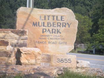
Trail Run – Little Mulberry Park Saturday May 21st at 9am

Little Mulberry Park - Entrance

Little Mulberry Park – foot trail

Fleet Fee of Johns Creek is doing a run THIS SATURDAY! The run starts at 9:00am at Little Mulberry Park. There are several different parking lots, so be sure to follow the directions provided below.

The run will be broken into both a beginner group and an advanced group. The beginner loop is going to consist of a 3 mile run along the Ravine Loop Trail. The trail is going to have decent elevation gains/losses and will force runners to focus on both running and hiking when necessary. The advanced loop extends closer to six miles and will traverse both the Ravine Loop and parts of the Fast Mulberry Trail.

There are four points that will be focused on during the run:
1. Map Reading: this is going to be necessary skill for our group runs going forward.
2.Trail Recognition: understanding how to handle different terrains as well as the ability to know where you are on the trail is essential.
3. GPS: The Fleet Feet team will spend a bit of time prior to the run discussing GPS on the trails and they will take the time after to answer any questions people have about different devices.
4. Running With a Partner: This is probably the most important thing to focus on as it instills good safety habits and makes the run more enjoyable.

Markers will be set up along the trail to inform runners of when to use their maps during the run. This is meant to be a lot of fun, but will also help reinforce necessary trail running skills.

Recommended Products:
Trail Running shoes, hydration belt or hand held water bottle, sweat wicking clothing, nutrition (i.e. gels or cliff bar), GPS device, and a phone if possible.

Address: 3855 Fence Road, Auburn,GA (note: the address listed brings you close to the park, if you use this plan on heading east on fence road once you reach the destination. The park will be on your left.

The page at Trimble Outdoors provides a bit of information about the trails at Little Mulberry including elevation, GPS coordinates, over 50 trail pictures and points of interest.

Share

Rogers Bridge Greenway Trail and River Overlook Ribbon Cutting, Feb 3rd


The City Of Duluth Parks and Recreation Department along with the City Planning Department will celebrate the ribbon cutting for the completed early phases of the Rogers Bridge Park Greenway Trail, River Overlook and Bikeway Trail on Thursday, February 3, 2011 at 2 p.m.  The Greenway Trail and River Overlook was largely funded through State of Georgia DNR grants, is adjacent to the Chattahoochee River representing the beginning of a larger planned trail system that will allow bikers and pedestrians access along the river.

The Bikeway Trail connects Rogers Bridge Park to Peachtree Industrial Blvd and these phases of the trail system through the park extend a distance of ¾ mile.  The total cost for both projects was $295,000.00. Rogers Bridge Park is located at 4291 Rogers Bridge Road.

For more information contact Kathy Marelle, Parks and Recreation Director, at kmarelle@duluthga.net or 678-417-9269.

Rogers Bridge Park is located within the 4000 Block of Rogers Bridge Road

[2] Pavilion (3100SF) [1] Sand Volleyball Court
[1] Playground [15 space] Gravel Parking Lot
[2] Horseshoe Pits [10] Picnic area (10 tables / 2grills)

Share

8 Multi-Purposed Trails (Paved and Soft Surface) for National Trails Day


Bogan Park Community Recreation Center
2723 North Bogan Road, Buford 30519
Park Hours: Sunrise to sunset unless posted otherwise
Two miles of trails

Dacula Park
205 Dacula Road, Dacula 30019
Dacula Activity Bldg., 2735 Old Auburn Ave., Dacula GA 30019
Hours: Sunrise until 11:00pm unless posted otherwise
1.75-mile paved, multi-purpose trail

George Pierce Park Community Recreation Center
55 Buford Highway, Suwanee 30024
Park Hours: Sunrise to 11:00pm unless posted otherwise
2.6-mile paved, multi-purpose trail • 1.2-mile soft surface trail

Harbins Park
2995 Luke Edwards Road, Dacula 30019
Hours: Sunrise to sunset unless posted otherwise
4.3-mile paved, multi-purpose trail
Soft surface trails for equestrian (7-mile), mountain biking (7-mile) and hiking (4.5-mile)

Ivy Creek Greenway
2020 Clean Water Drive, Buford GA 30519
near the corner of Buford Drive and Mall of Georgia Boulevard, Buford GA
1.3-mile paved, multi-purpose trail • 1.4-mile soft surface trail

Little Mulberry Park
Hours: Sunrise until sunset unless posted otherwise
Info & Rentals: 770.614.2060
Trail Info: 770.978.5270
5 miles of paved, multi-purpose and soft surface trails for equestrian and hiking

Settles Bridge Park
380 Johnson Road, Suwanee 30024 Hours: Sunrise until sunset unless posted otherwise
1.6-mile paved, multi-purpose trail • 2.9-mile soft surface trail

—————————————————————————–

Tribble Mill Park
2125 Tribble Mill Parkway, Lawrenceville 30045
(off of New Hope Road) Hours: Sunrise until sunset unless posted otherwise
3.4-mile paved, multi-purpose trail
• Soft trails for equestrian, mountain biking and hiking

Grayson
Take I-285, Exit 39 B, the Stone Mountain Freeway East towards Snellville and Athens for 16.3 miles to SR 84 (begin watching for it after crossing Scenic Highway (SR 124) in downtown Snellville). Turn left and travel 5.6 miles to a 4-way stop at New Hope Road. Turn right and travel 0.5, making a right on Tribble Mill Parkway. After entering the park turn left in the first parking lot and return to the trail.
Tribble Mill Park Trail
Tribble Mill Park Trail maps and directions

Directions to:
Tribble Mill Park Trail
Follows a paved loop trail around the east end of Ozora lake. Many unpaved paths join this trail for hiking and mountain biking opportunities

Share

Grand Opening Celebration of Freeman’s Mill Park Saturday, May 8


Grist Mill

The Grand Opening Celebration of Freeman’s Mill Park will take place Saturday, May 8, 2010 at 10am. Members of the board of commissioners, the Recreation Authority and active members of the community will performa Ribbon-Cutting Ceremony at 10 a.m.

The festivities will take place between 10:30a.m. and 2:00 p.m. with free kids activities, historical demonstrations, guided tours and more.

The park features a restored historic gristmill (a building in which grain is ground into flour), playground featuring replica gristmill, a half mile paved multi-purpose trail and restrooms.

According to OurTown (Snellville), “The mill was built sometime between 1868 and 1879 by brothers John Griffin Loveless and Levi J. Loveless. In 1913 W. Scott Freeman and his son, Winfield, owned it until it was purchased in 1915 by Newt Pharr. Winfield descendants continued to operate the mill through the twentieth century. In the late 1990’s the mill was placed on the National Register of Historic Places for its significance in architecture, engineering, industry, and social history. As of 1996, the mill was the only working grist mill remaining in Gwinnett County .”

Park hours are from sunrise until sunset unless posted otherwise.
Park Info:    770.822.8840
Historic Info:    770.904.3500

Location: 1401 Alcovy Road, Lawrenceville, GA 30045

MASTER PLAN (PDF Downlaod)

Share